
Now California Has Declared One Too. Here’s What It Means for Our Homes.
I’ve worked on this coast long enough to know what a normal winter does to our beaches. Sand moves offshore, the coves get rocky, and by summer most of it comes back.
What happened this September wasn’t normal.
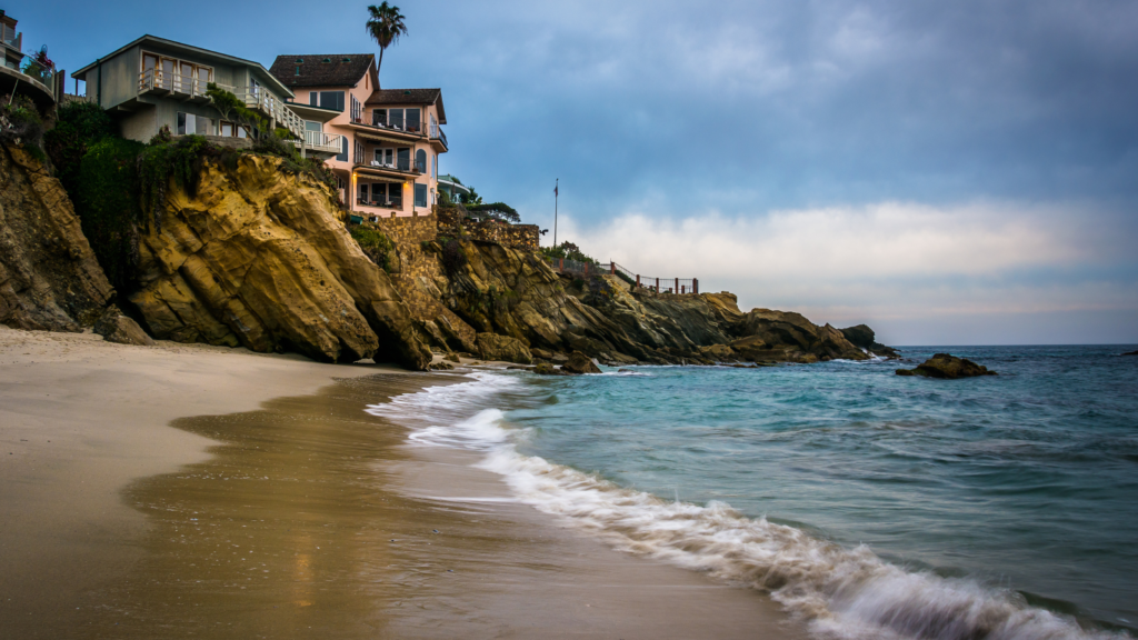
On Thursday, September 10, the City of Laguna Beach proclaimed a local emergency over coastal erosion and sand loss. Swell from former Hurricane Marie had stripped beaches up and down the coast. Six oceanfront homes on Ocean Way and Lagunita Drive were yellow-tagged because of compromised seawalls. Aliso Beach was the hardest hit — its parking lot had already partially closed the week before, and by that Thursday the beach itself was shut down while crews assessed nearby infrastructure and homes. NBC Los Angeles reported that erosion at Shaw’s Cove had exposed rocks with very little sand left.
City Manager Dave Kiff put it plainly, as reported by Voice of OC: “Most of us have never seen this much sand leave our beaches at once.” He added, in comments reported by LAist, “We expect it to come back, but we are not counting on it, and with a very strong El Niño forecast we need the ability to act quickly to protect homes, beaches and public infrastructure.”
Eleven days later, the state agreed with him. On September 21, Governor Newsom proclaimed a statewide state of emergency ahead of the coming El Niño season, directing agencies to stage flood-fighting equipment, prepare infrastructure and reduce flood, landslide and coastal risk. “We are preparing for this El Niño early,” the Governor said, “because every Californian deserves to be safe in their home.”
I want to walk you through what’s actually going on: what’s causing it, what other coastal cities are already doing, what I think Laguna needs to do now, and what all of it means if you own a home on this coast or you’re thinking about buying one.
What we’ve seen this summer and fall
The emergency didn’t come out of nowhere. It capped a summer of warning signs.
- June 26: a section of bluff collapsed at Brooks Street during a south swell combined with high tides, Surfer reported.
- August 26: a seawall in front of a Pearl Street home built in 1951 cracked and partly collapsed overnight. A family member told ABC7 that the path to the sand had gone from a three-foot step to “an 18-to-20-foot drop.”
- August 31: waves pushed sand and water onto the Aliso Beach parking lot, and the west lot closed.
- September 10: the emergency proclamation. Under California law it runs for seven days unless the City Council ratifies and extends it. NBC Los Angeles reported that it “allows the City to move immediately on emergency shoreline protection, sand placement, debris removal, assessments and repairs without the delay of ordinary contracting procedures.”
We weren’t alone. Dana Point declared its own local emergency and, according to the City of Dana Point’s Beach Road updates, had 10 homes red-tagged and seven yellow-tagged as of September 14. Owners there are installing a boulder revetment behind their homes under emergency permits issued directly by the Coastal Commission, working when tides are low enough. In San Clemente, Voice of OC reported the coastal rail line closed on September 6 after rain from former Hurricane Marie and high surf, with the closure extended by continued high tides — the latest in a string of shutdowns on that stretch in recent years. San Clemente’s pier damage was estimated at roughly $300,000.
And the season is just starting. The Kelvin wave now moving up the coast — a broad bulge of warm water and elevated sea level — is expected to reach San Diego in roughly the first half of October, with Los Angeles following about a week later. It could add six to twelve inches, bringing about a foot of total sea level rise by mid-October. The USGS’s Sean Vitousek has described it as the second of what could be five or six such waves tied to this El Niño. NOAA’s Climate Prediction Center puts the odds of a very strong El Niño this fall and winter at greater than 90%, with a 75% chance it reaches historic strength from October through December. The next official update lands October 8.
What’s actually causing it
It’s tempting to blame one storm. The storm is the trigger, not the cause. Four forces are working together.
1. We cut off the sand supply. Most beach sand in Southern California was carried to the coast by rivers and creeks. Then we dammed and channelized them for water supply and flood control. A study by Slagel and Griggs — the latter one of California’s best-known coastal geologists — estimated that dams and inland development have reduced Southern California’s annual sand supply by about 50%. That sand is sitting behind dams and in debris basins instead of on our beaches.
2. Armoring moves the problem, it doesn’t solve it. A seawall protects what’s behind it. It doesn’t protect the beach in front of it. As Griggs has written, wherever a hard structure is built on a retreating coastline, “the shoreline will eventually migrate landward behind the structure.” The beach narrows against the wall until there’s nothing left at high tide. He also found that 38% of the Southern California coast is now armored.
3. The ocean is rising. Under the state’s 2024 sea level rise guidance, adopted by the Coastal Commission, the “intermediate” scenario projects about 0.8 feet of rise by 2050 and about 3.1 feet by 2100. That doesn’t sound dramatic until you remember that every storm, king tide and swell now starts from a higher baseline. As Vitousek told Fortune this week: “The constant pressure is sea level rise. It is going to keep rising, and the beaches will retreat landward.”
4. Bigger storm seasons. During the 2015–16 El Niño, the U.S. Geological Survey found that West Coast winter beach erosion was 76% above normal, “by far the highest ever recorded.” This winter’s forecast is for a stronger event.
Put those together and you get the outlook the USGS published from its CoSMoS model: 31 to 67 percent of Southern California beaches could erode completely, back to the sea cliffs or the seawalls, by 2100 if sea level rises three to six feet and we don’t intervene.
The encouraging part of that same study is easy to miss. The USGS noted that 72% of Southern California beaches actually grew historically, because of large sand nourishment projects since the 1930s. Vitousek’s conclusion was that “human-management efforts must increase” to keep them. Beaches can be managed. It just takes planning, sand and money.
What other coastal cities are doing
The good news is that Laguna doesn’t have to invent anything. Our neighbors have been working on this for years, with different strategies and very different results.
San Clemente: sand, and a vote. The Army Corps of Engineers began a 50-year sand replenishment project there, with 251,000 cubic yards in the first placement between Linda Lane and T-Street and about 2 million cubic yards over the life of the project, renourished roughly every six years. The construction phase is funded at about $14.3 million, split 65/35 between the federal government and the city. Separately, the Orange County Transportation Authority’s coastal rail emergency program totals $310.5 million and includes about 540,000 cubic yards of sand between North Beach and Mariposa Point. And on November 3, San Clemente voters decide on a one-cent sales tax increase — taking the city rate to 8.75% and raising roughly $15 million a year — earmarked for sand placement and wildfire prevention. A half-cent version fell short of the two-thirds threshold it needed in 2024. Fortune reported this week that San Clemente is facing a sand deficit of roughly 3 million cubic yards, which would take something like 300,000 truck trips to fill. That is the scale of the problem in one number.
Encinitas and Solana Beach: the long game. These two cities partnered with the Army Corps on a 50-year project. Encinitas received about 340,000 cubic yards up front, with about 220,000 cubic yards planned every five years. Solana Beach received 700,000 cubic yards starting in January 2024, with more every ten years through 2074, targeting a 150-foot-wide beach. The construction phase alone was about $49.6 million. What stands out to me is the commitment: a plan that outlasts any city council.
Newport Beach: building for higher water. Newport has written future sea levels into its harbor standards. A 2025 city zoning resolution cites a minimum bulkhead height of 10.9 feet (NAVD 88), designed so it can be raised to 14.4 feet. Newport also participated in the Army Corps’ 2023 Orange County nourishment project.
Del Mar: the cautionary tale. Del Mar’s council removed “managed retreat” from its sea level rise plan, calling it “not a necessary or feasible strategy.” The Coastal Commission pushed back, and in 2021 the city withdrew its plan rather than accept the Commission’s changes. Years of conflict, and no certified plan. When a city and the Commission can’t agree, homeowners live with the uncertainty.
What Laguna needs to do now
This is my opinion, as someone who works with Laguna homeowners every day and watches how uncertainty shows up in their decisions.
1. Get the sea level rise plan done early. State law already requires it. SB 272, signed in 2023, requires every coastal city to have a sea level rise plan in its Local Coastal Program by January 1, 2034. Cities with approved plans get priority for state adaptation funding once the Legislature appropriates it. 2034 is the deadline, not the goal. Getting there first means getting to the front of the funding line.
2. Chase the money that already exists. Proposition 4, the 2024 climate bond, includes $890 million to restore coastal areas and protect them from sea level rise, according to the Legislative Analyst’s Office. San Clemente, Encinitas and Solana Beach all show what federal cost-sharing through the Army Corps can deliver. And the Governor’s September 21 emergency proclamation is exactly the kind of moment when state resources move. Laguna should be in every one of those conversations.
3. Understand our own sand. Laguna’s beaches behave differently from San Clemente’s long, open shoreline. Many of ours are pocket coves between rocky headlands. The South Orange County Beach Coalition has listed updating the sediment budget for Laguna Beach as a priority action. You can’t manage sand you haven’t measured.
4. Give homeowners a clear path. Right now an oceanfront owner facing a failing seawall has to navigate emergency permits, the city, the Coastal Commission and their insurer, often in the middle of a swell. The city could publish plain-language guidance: who issues what, how fast, and what the long-term permitting rules are once the emergency ends.
5. Plan for the whole coast, not one wall at a time. Seawall-by-seawall decisions are how you end up with a hardened coastline and no beach. A neighborhood-scale approach, covering public beaches, access and private property together, is harder politically and far better for everyone who owns, visits or sells here.
What this means for coastal homeowners
This is where it gets personal for my clients and local homeowners.
Your right to protect your home depends on its history. The Coastal Act allows seawalls to protect “existing structures” in danger from erosion. A 2024 appeals court decision, Casa Mira HOA v. California Coastal Commission, upheld the Commission’s reading that “existing” means structures that existed before January 1, 1977. Newer homes are often built under permits that bar future shoreline protection altogether.
A big remodel can change that history. The case I think every oceanfront owner in Laguna should know is 11 Lagunita Drive. The Coastal Commission found that an extensive remodel turned the original 1952 home into new development. The seawall permit carried a condition that it would expire if the home were significantly remodeled. In 2018, the Commission ordered the seawall removed and imposed a $1 million penalty. An appeals court upheld both in 2020, and a Commission report from June 2025 noted the seawall had finally come out. Before you plan a major renovation on the bluff or the sand, understand what it could do to your protection.
Setbacks shape what you can build. Laguna’s Land Use Element calls for a minimum 25-foot setback from the bluff edge, and the Coastal Commission has enforced it. In April 2019, it denied a Laguna addition 7–2 because it would have been sited on the bluff face. Where exactly the bluff edge sits is often the fight in these cases.
Insurance probably doesn’t cover it — and the clock is running. Standard homeowners policies exclude “earth movement,” which includes landslides and erosion. Flood insurance through the National Flood Insurance Program also excludes loss caused directly by earth movement. On September 22, Insurance Commissioner Ricardo Lara urged Californians to review their coverage before these storms arrive, noting that standard homeowners and renters policies typically exclude flooding, mudslides and debris flows — and that NFIP flood coverage carries a 30-day waiting period before it takes effect. Call your insurance agent this week, not in December.
The disclosure forms don’t ask about it. California’s statutory Natural Hazard Disclosure covers flood zones, fire zones, dam inundation, earthquake faults and seismic hazards. Sea level rise and coastal erosion aren’t on the list. The California Association of Realtors does include sea level rise in its statewide buyer and seller advisory. For your specific disclosure obligations as a seller, talk to your attorney.
What it does to value. Here’s the honest answer: the research is still catching up. The most-cited national study, by Bernstein, Gustafson and Lewis in the Journal of Financial Economics, found that homes exposed to sea level rise sold for about 7% less than comparable unexposed homes the same distance from the beach. I haven’t found a peer-reviewed study measuring the same effect specifically in Southern California.
What I see in practice is a market that’s starting to separate. Two oceanfront homes can look similar in photos and be completely different assets. One is a pre-1977 home with a permitted, well-maintained seawall and a clean permit history. The other has an unclear bluff edge, a past remodel that may have changed its status, and a permit condition that bars future protection. Buyers and their lenders are asking more of these questions, and after this September, they’ll ask more.
For sellers, that means documentation is value. For buyers, it means doing coastal due diligence before your contingencies run out, with a geotechnical engineer, your insurance agent and, when needed, a land-use attorney.
If you own on the coast, here are a few important questions to ask:
- When was the home originally permitted, and was it before 1977?
- What permits exist for the seawall or bluff protection, and do any carry conditions or expiration clauses?
- Where is the bluff edge on your lot, according to the city?
- Has any past remodel been large enough to count as new development?
- When was the last geotechnical or seawall inspection, and what did it recommend?
- What exactly does your insurance cover, and what does it exclude?
The bottom line
I don’t think this is a reason to fear the Laguna coast. People have loved this shoreline for a century, and they’ll keep paying a premium to live on it.
But the days of assuming the sand will simply come back are over. The cities doing this well treat beaches as infrastructure, with long-term plans, dedicated money and regional partners. Laguna has every advantage: a committed community, an engaged city and some of the most valuable coastline in the state. What we need now is urgency.
If you own on the coast, the best time to understand your home’s position is before the next swell, not during it. With a Kelvin wave arriving in October and the state already in an emergency proclamation, that window is this month.
This article is general information, and could include non updated information as this is not legal, insurance or engineering advice. For your specific property, talk to your attorney, insurance agent or a licensed geotechnical engineer.
Own a home on the Laguna coast? Start with a free, no-obligation home valuation. I’ll look at your home the way today’s buyers will, including its coastal position and permit history. Or grab my Orange County Seller’s Guide.
Thinking about buying on the coast? My Orange County Home Buyer’s Guide covers the due diligence that matters most on coastal property.
Jaleesa Peluso | Berkshire Hathaway HomeServices California Properties
Phone: (949) 395-0960 | Email: Jaleesa@jaleesapeluso.com
DRE #01935097